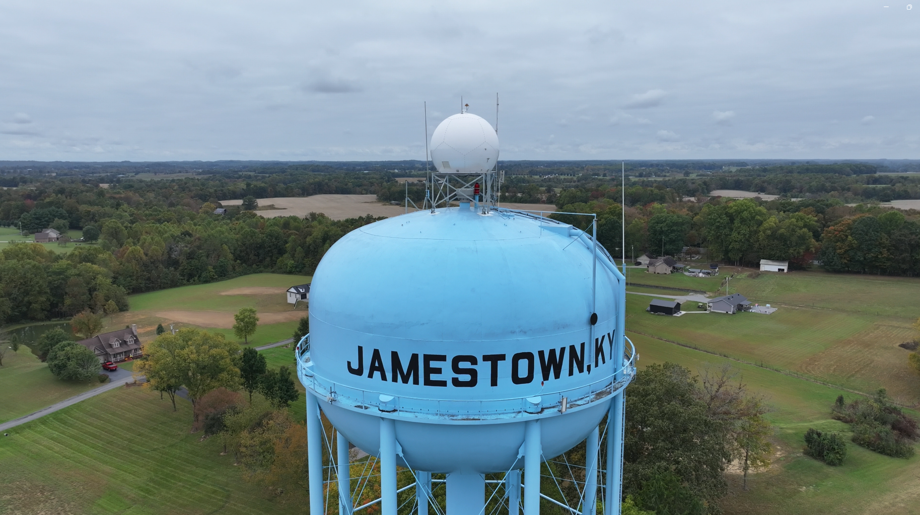
LOUISVILLE and JAMESTOWN, Ky. — Climate tech pioneer Climavision’s network of weather radars continues to grow, with its first installation in its home state of Kentucky. The new radar in Jamestown, 75 miles Southwest of Lexington, fills a critical low-level coverage gap in South Central Kentucky, covering the popular recreational destination of Lake Cumberland and the I-75 corridor.
It’s an especially significant milestone for the Louisville-based company, since the company recently announced a contract with NOAA that will allow the National Weather Service to access its data.
“The goal is to help the National Weather Service save lives by providing earlier detection of dangerous weather,” said Climavision CEO and Co-Founder Chris Goode, a Kentucky native. “So it’s particularly important to us to make that kind of difference here in the Commonwealth.”
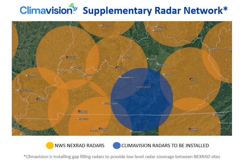
Since the 1990s, the National Weather Service has monitored severe weather across Kentucky and the nation using NEXRAD S-band radars. However, low level data voids can exist between these systems as the radar beam moves higher in the atmosphere the further it gets from the radar location. That leaves many rural areas are left exposed to weather phenomena that often happens in the lower atmosphere such as flash flooding, sleet, ice, and tornadoes.
That’s why Climavision is installing its own network of weather radars to provide a new level of surveillance in between NEXRAD sites. Climavision’s dual-polarization, X-Band weather radar is designed specifically to fill these gaps to provide the highest resolution view of what’s happening nearest to the ground.
 The company currently has 20 radars providing data to commercial forecasters, broadcasters and emergency officials. The new partnership with NOAA lets National Weather Service forecasters also access the service through the National Mesonet Program, a network of sensors that helps them decide on watches, warnings and other notifications to the public.
“Our radar data can dramatically improve the Weather Service’s real-time insight into areas like South Central Kentucky,” said Goode. “Interstate 75 makes this a major travel corridor, and Lake Cumberland makes the area a destination in its own right. Our solution could make a critical difference for people who live and work there as well as those passing through.”
The company is already at work addressing other low-level gaps in Kentucky and around the country, planning to eventually scale the network to more than 200 radar systems.